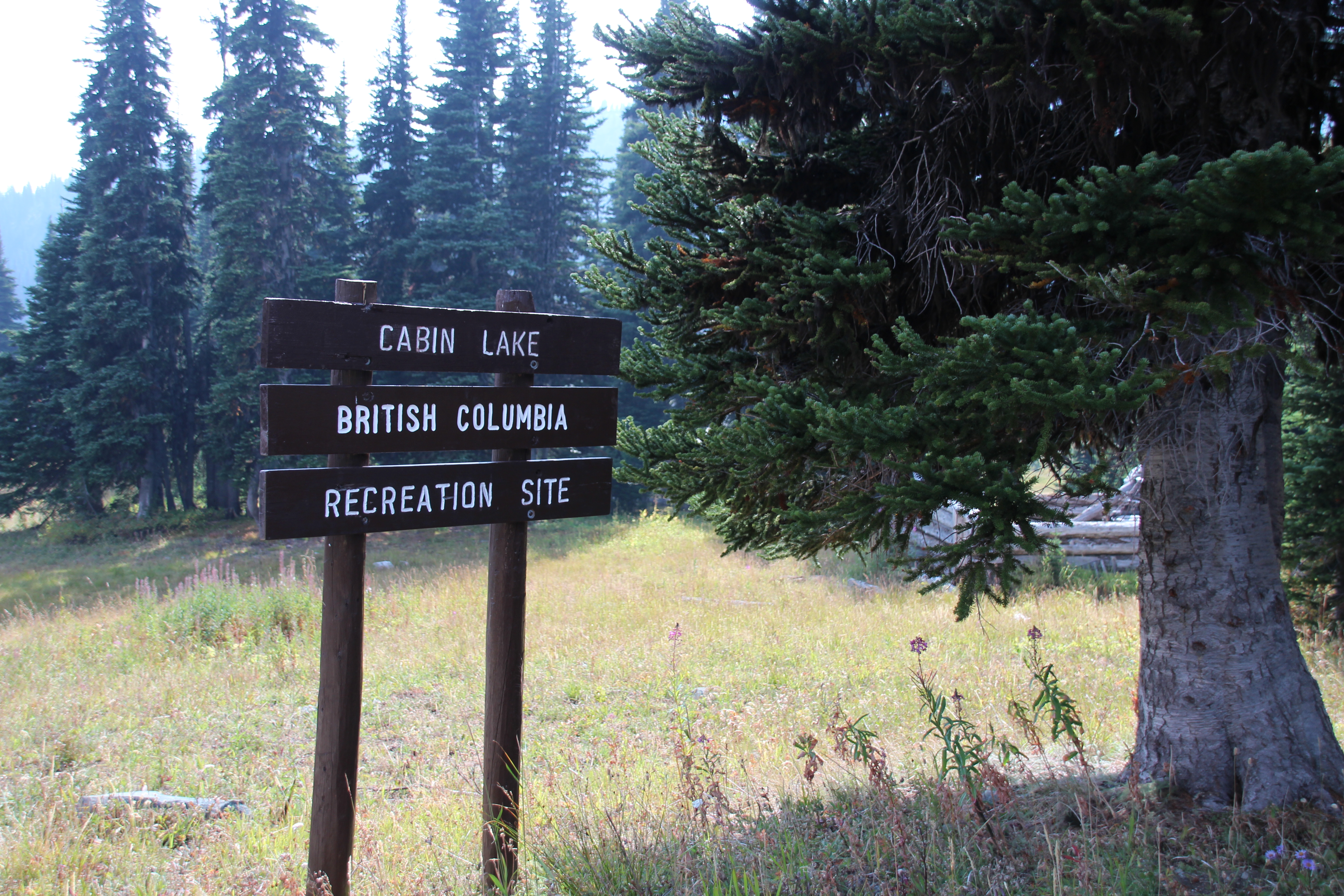
Cabin Lake
A couple of years ago a group of us in two pickup trucks drove on the worst road I’ve ever been on to get a Gold Country geocache at Cabin Lake. We were trying to finish the first series of Gold Country geocaches and this was one of the hard ones to get. The cache itself is pretty easy to find and Cabin Lake is a beautiful spot. The problem here is THE ROAD FROM HELL!
Leaving from Highway 8 between Merritt and Spences Bridge, one of my favourite roads by the way, the road to Cabin Lake starts off innocently enough – a 25 Km winding gravel road that is well maintained, dotted with lovely little ranches and acreages. The road climbs up into the mountains before reaching a Y turnoff. This is where things get ugly. The last 5 Km to Cabin Lake is by far the worst road I’ve ever been on… no… seriously… THE WORST!
It took us a good hour to travel 5 Km. Several times we had to get out of the trucks to see how we could get through difficult spots – the whole road was difficult. One time we had to all stand on the back bumpers of the trucks so the front bumpers would clear the gullies we were driving through. At times we got out and added rocks so at least three wheels could touch at once. My mother swore she would never travel on that road again (and she has remained true to her word). On that trip we found the geocache and then split up. We (John Buchanan, Yvonne Odber, Sophie Odber, Mom and Me) were going to get another harder Gold Country cache at the Cornwall Hills forestry lookout near Ashcroft. Rejean and Alisa, in the other truck, were going to do a hike to a nearby plane crash site. We all wished we could do both, but we chose Cornwall. Still, the plane crash was in the back of our minds but thanks to that road we pretty much ruled out ever going back.
When it came time to pick things to do for my 50 Crazy Things the plane crash hike was on my list. I sent John a message asking if he and Ava (his truck) would like to go back to Cabin Lake to do the hike. He flat out said no. Then he sent another message saying, “Ava was kicking up her heels/tires, begging to go… I guess we’re going”.
It was crazy to do that road once having heard what it was like. It was absolutely nuts to go in again KNOWING what the road was like.
So, on August 23rd we loaded up in two trucks and nine of us drove up into the mountains looking for adventure and the wreckage from a plane crash. In Ava was Yvonne Odber, Sophie Odber, and John. In the other truck (no name) was Landon Dick, Jaydan Dick, Krista Dick, Jody and Gerry Lenarcic, and me. Smoke from fires in Washington State made the trip hazy and in a way it set the mood for the haunting journey we were about to make.
The Road
Oddly enough, the road was definitely not as bad as it was the first time. Sure, the trucks were totally pinstriped by trees and brushes by the time we got back (that’s how you know you had a good time in the bush), and at times it felt like we were on a roller coaster, but we never had to get out and stand on the bumper so I say that was a win. It didn’t take us an hour this time, maybe 45 minutes, and then we were at the lake where we were surprised to see multiple campsites in use by campers driving vehicles that had also survived the road. I don’t want to leave you with the wrong impression, though. It’s still the worst road I’ve ever been on!
The Hike
A 10 Km hike (round trip) to the plane crash site on Stoyoma Mountain, the trail is not terribly difficult or dangerous.

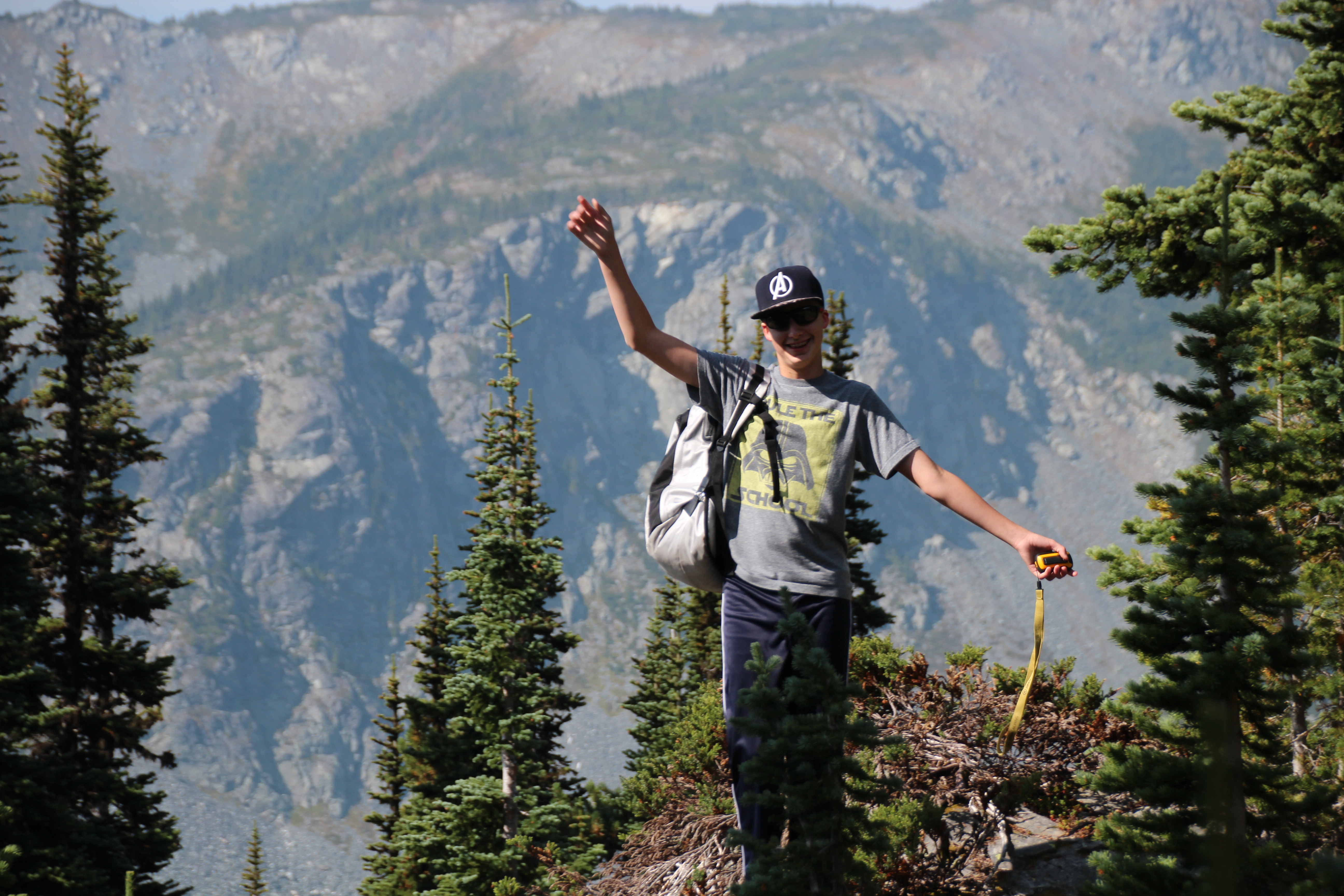
Figuring out what trail we’re supposed to be on
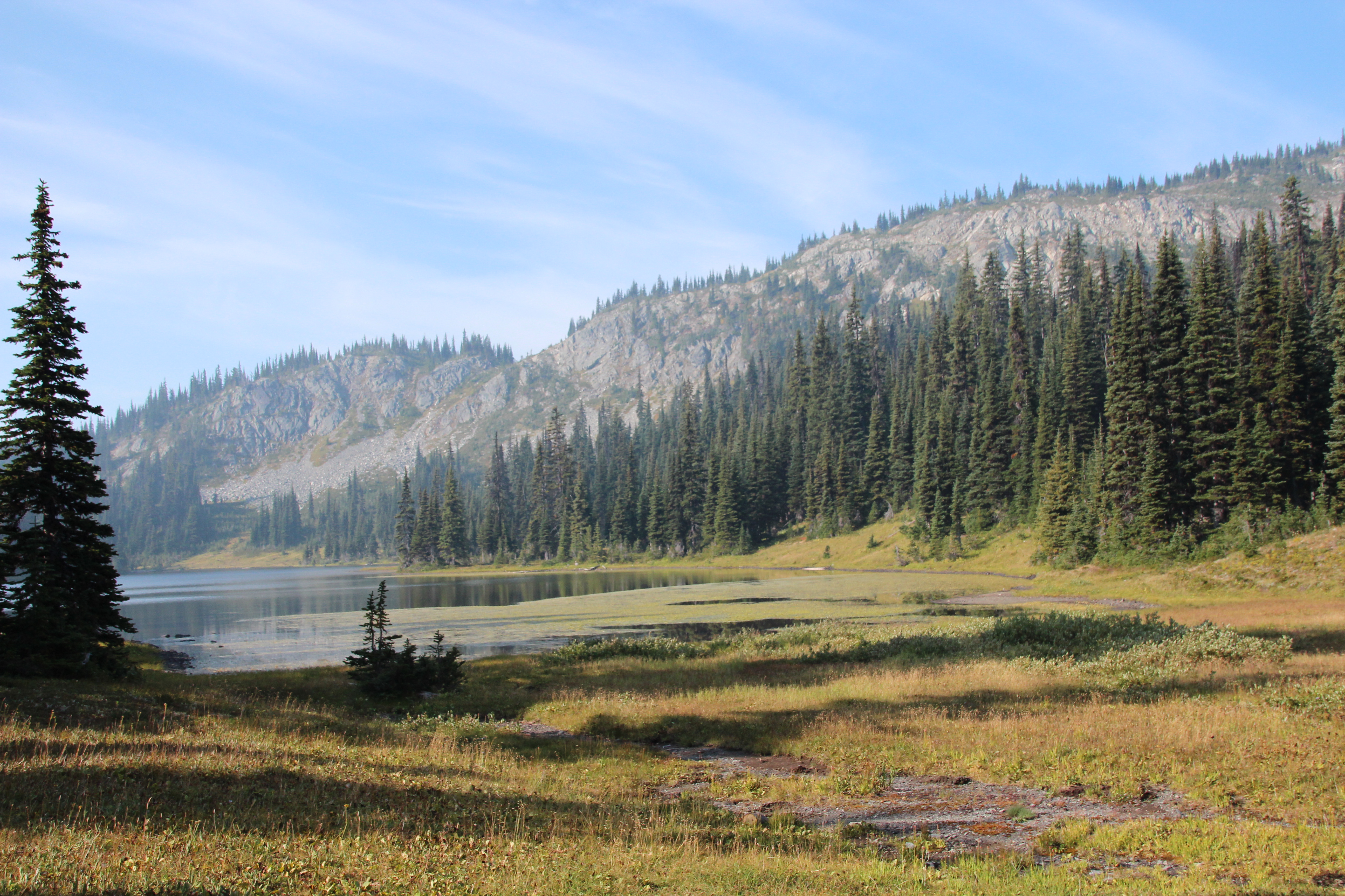
The smoke creating a haze at Cabin Lake
Cabin for rent at Cabin Lake
Someone called these Hippy Sticks
Jaydan – King of Balance
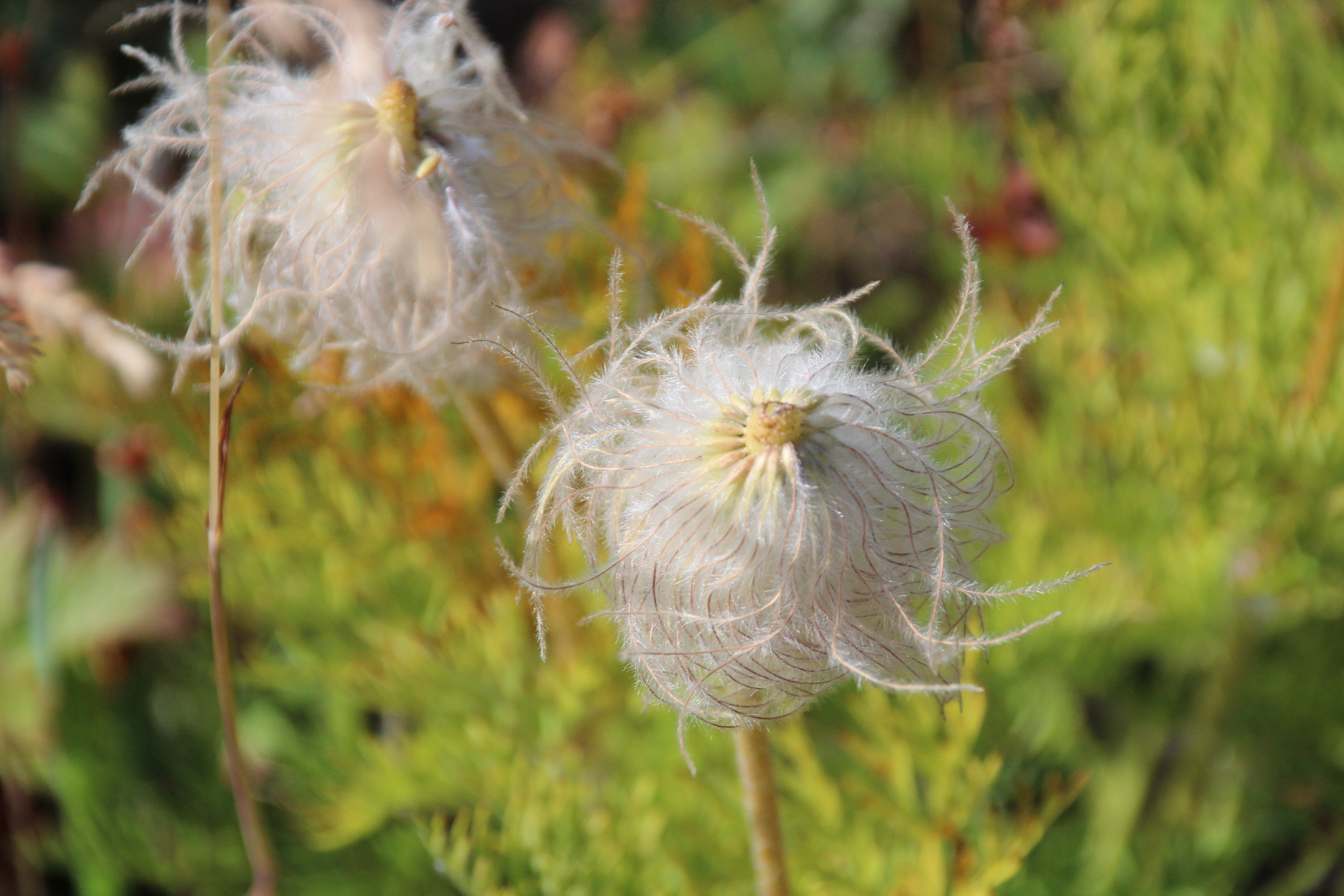
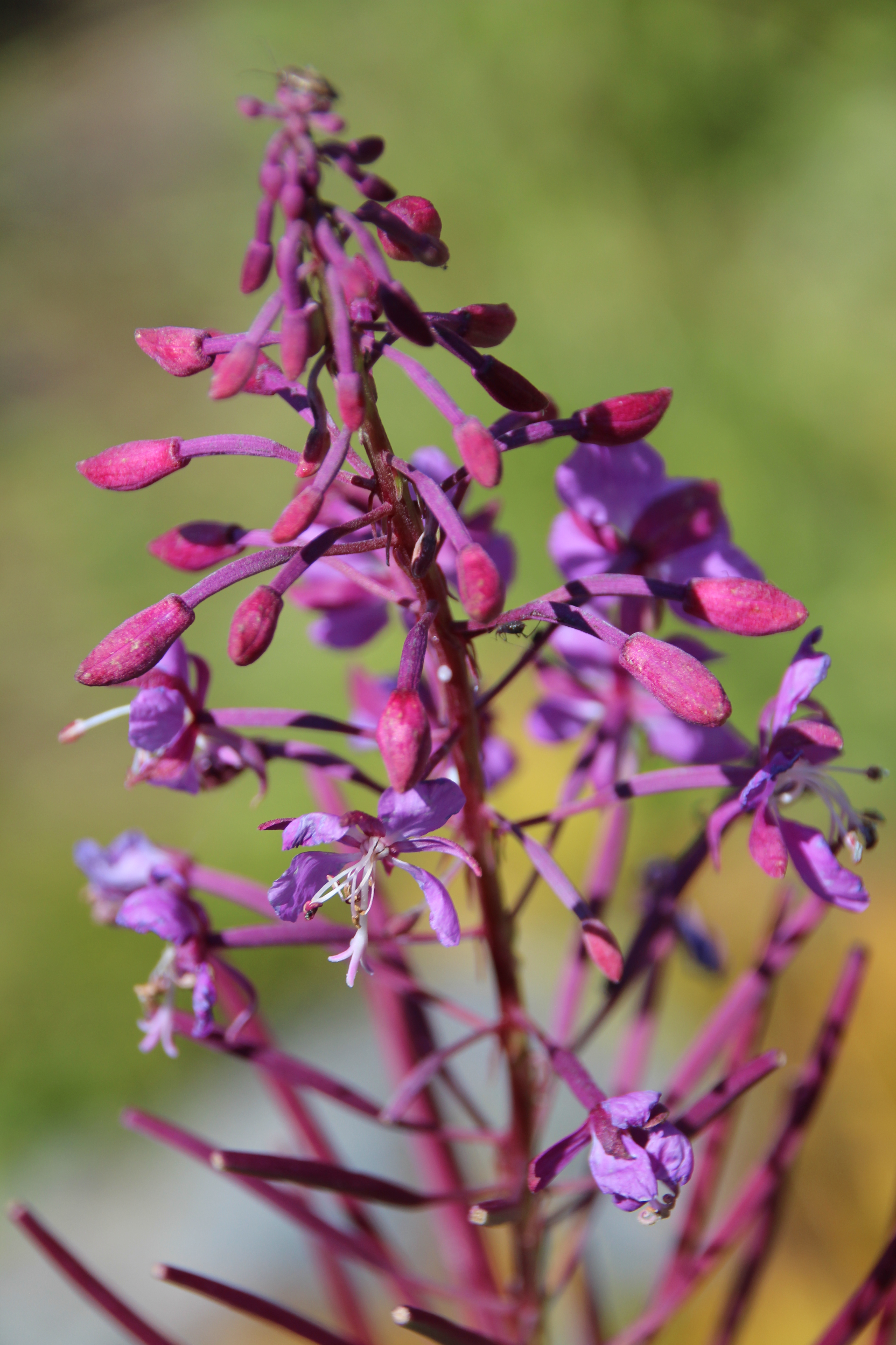
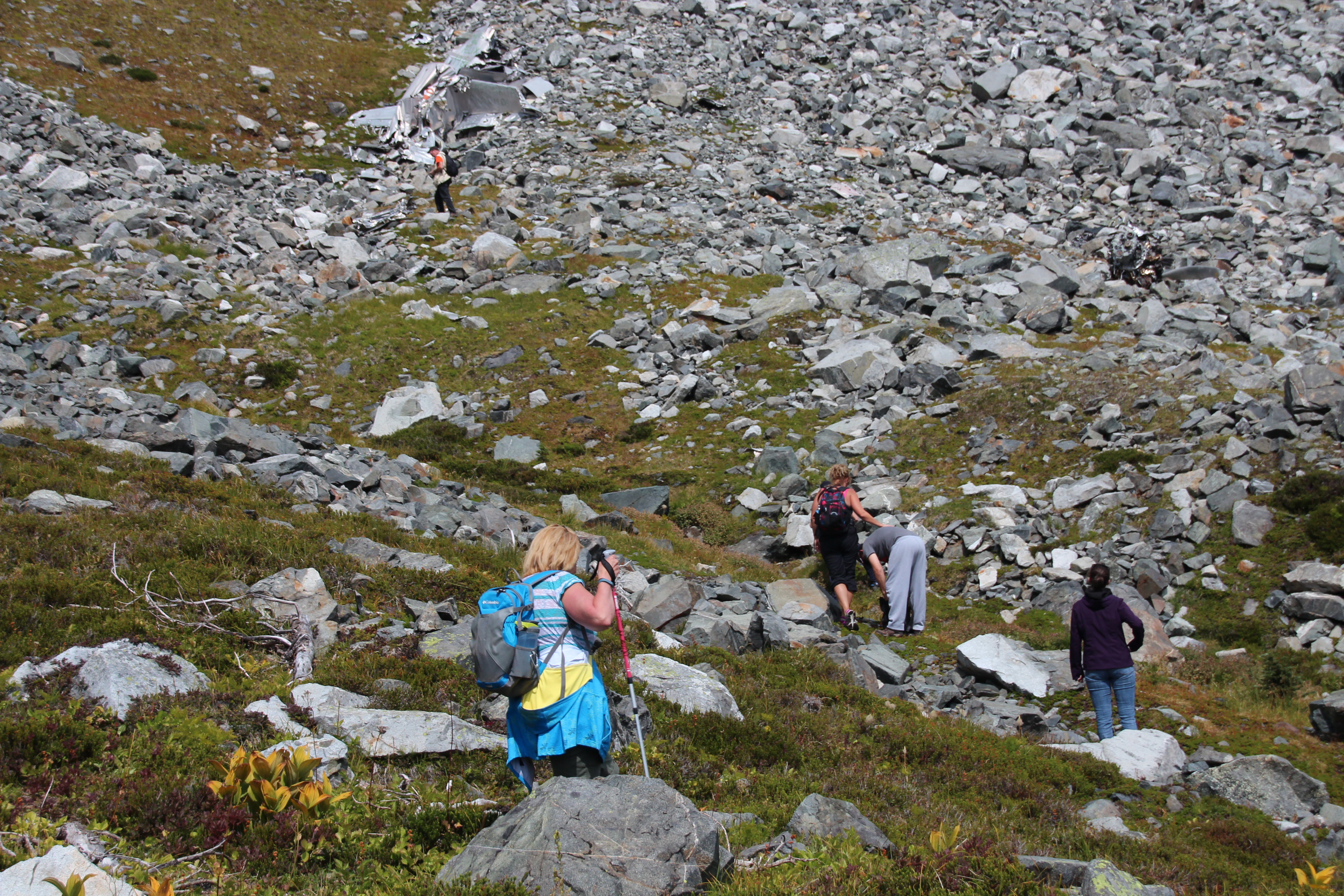
Leaving from the lake we climbed further into the smoke through alpine meadows, catching spectacular views that were enhanced by the smokey sky. The wildflowers that paint the landscape with bright colours in alpine regions were nearing the end of their season but still spectacular. The scenery was magnificent. Eventually we found ourselves above most of the smoke in a rocky valley along the slope of Mt. Stoyoma.

The smoke in the valley.
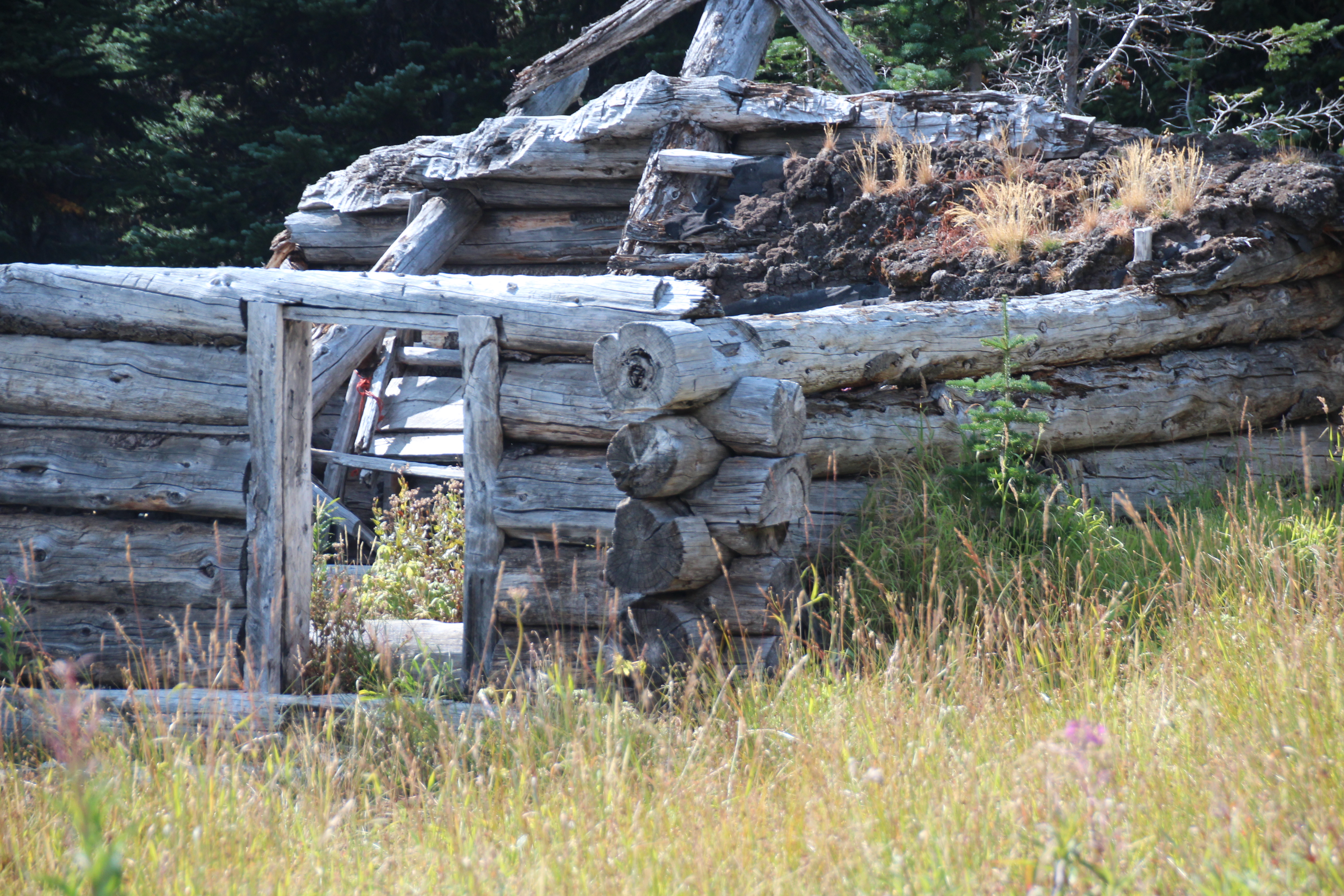
The Crash Site
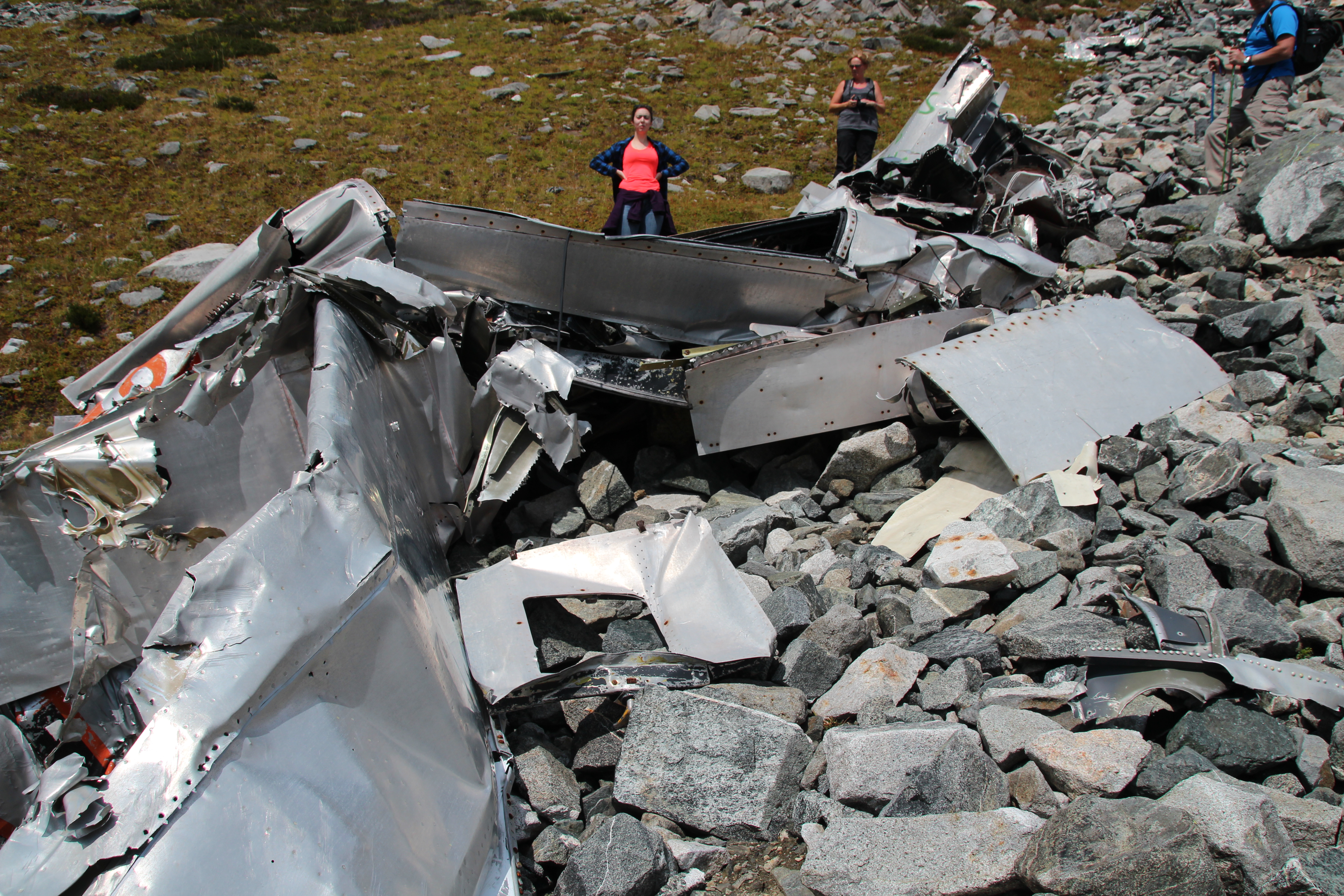
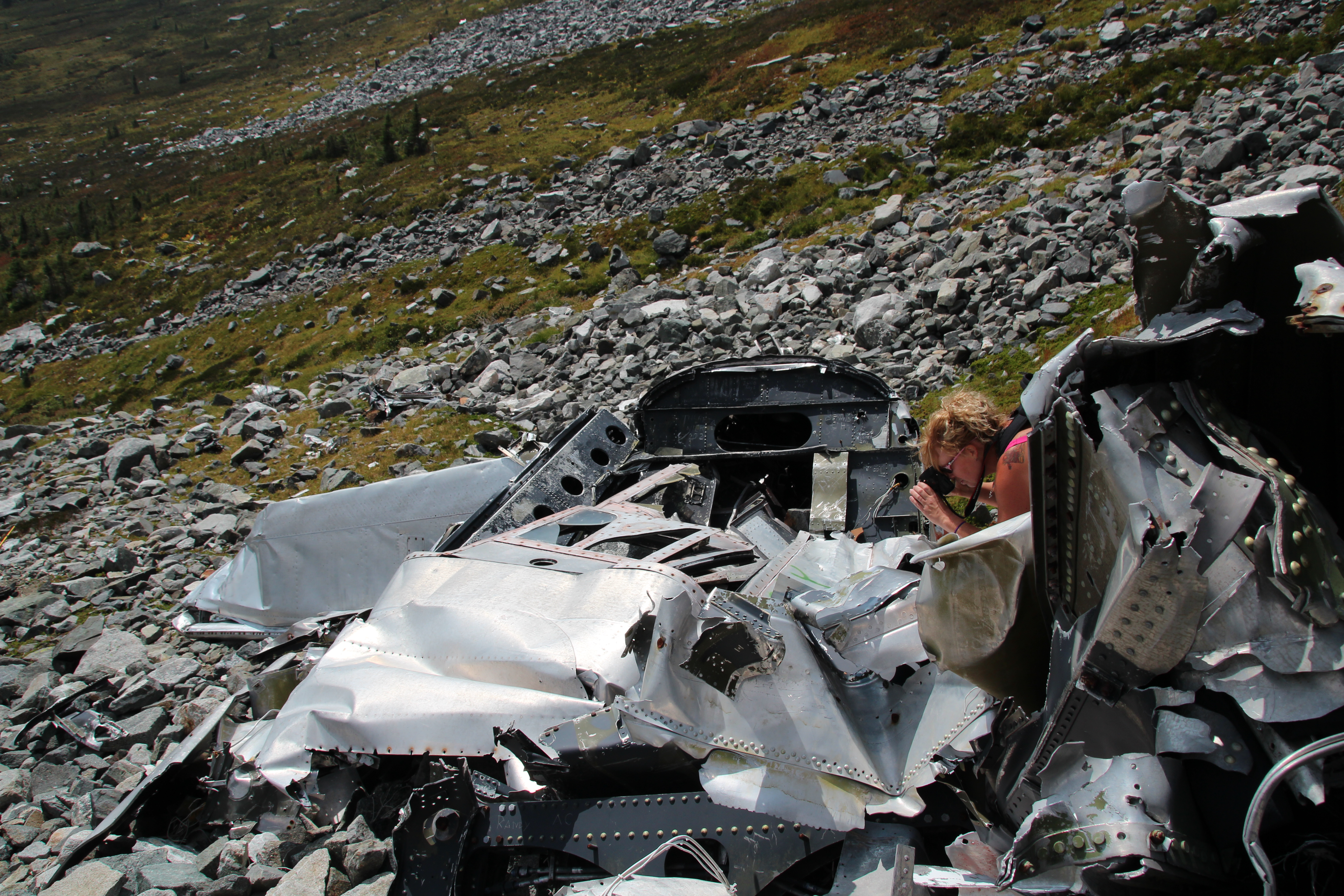
Our first view of the plane crash site came as we left a grove of thick trees that opened into the exposed valley. What seemed like small pieces of metal were glinting in the sun on the slope of the mountain. I had a hard time seeing it at first, it looked like a natural part of the rocky slope. As we got closer, though, the size of the pieces became evident.

Even with a zoom lens the wreckage looked small from a distance.
Landon, a volunteer firefighter, surveying the landscape.
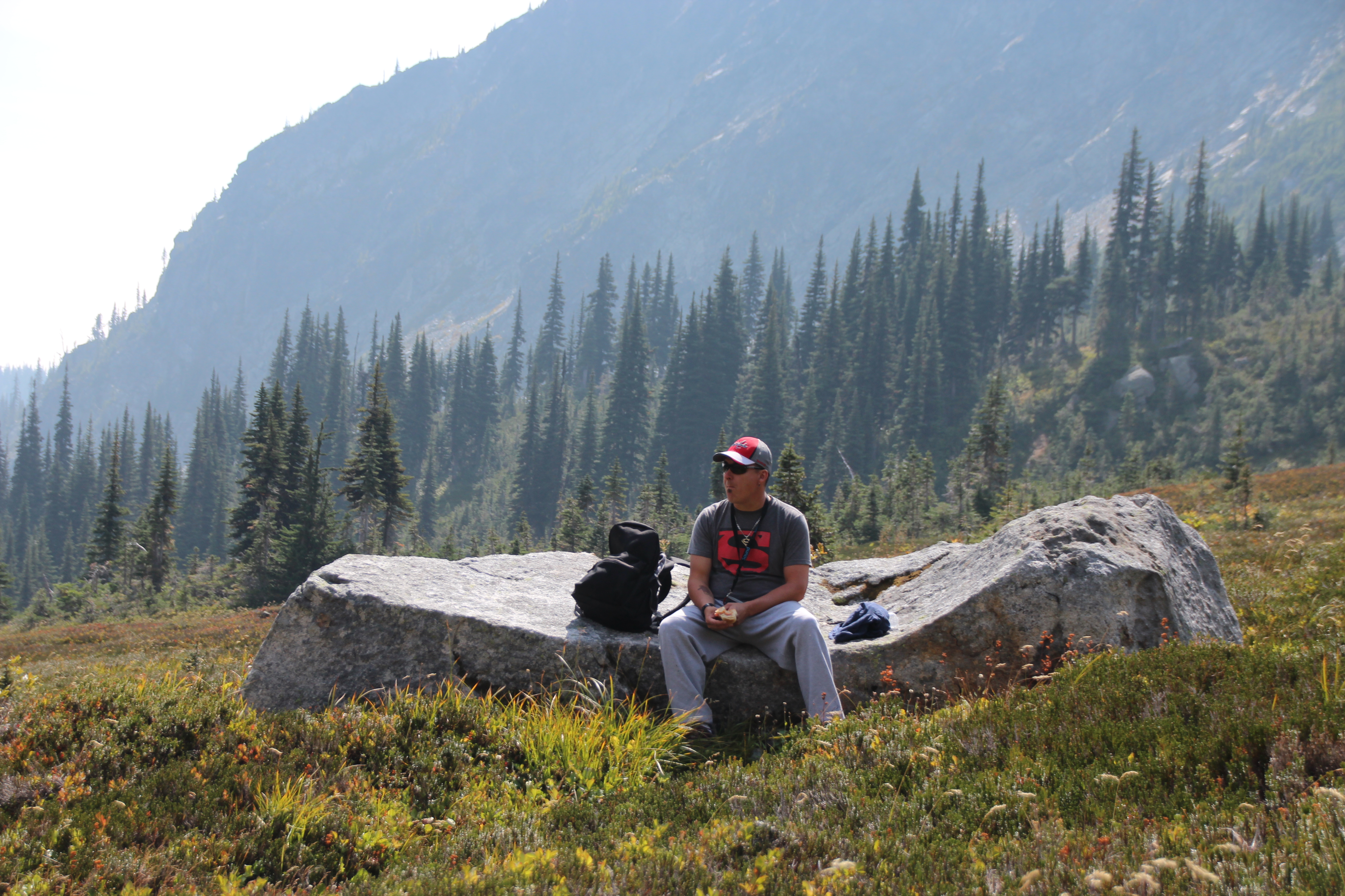
We stopped in the valley and ate lunch on some large boulders before we picked our way up to the wreckage. Arriving at the wreckage, which is strewn in large and small pieces down the mountainside, the size became much clearer. The plane was large, and the scope of the debris field gave us a chilling idea of how violent the crash had been.
Krista and Jaydan
This was when I realized how grateful I was that I was with the people I was with. There was no joking, or disrespectful talk when we were at the wreckage. It wasn’t necessarily somber, but it was reflective. A man had died here, and he did it providing a service that people who live in BC’s interior rely on every summer. Living in a world of trees and hot, dry desert summers we are nothing without firefighters.
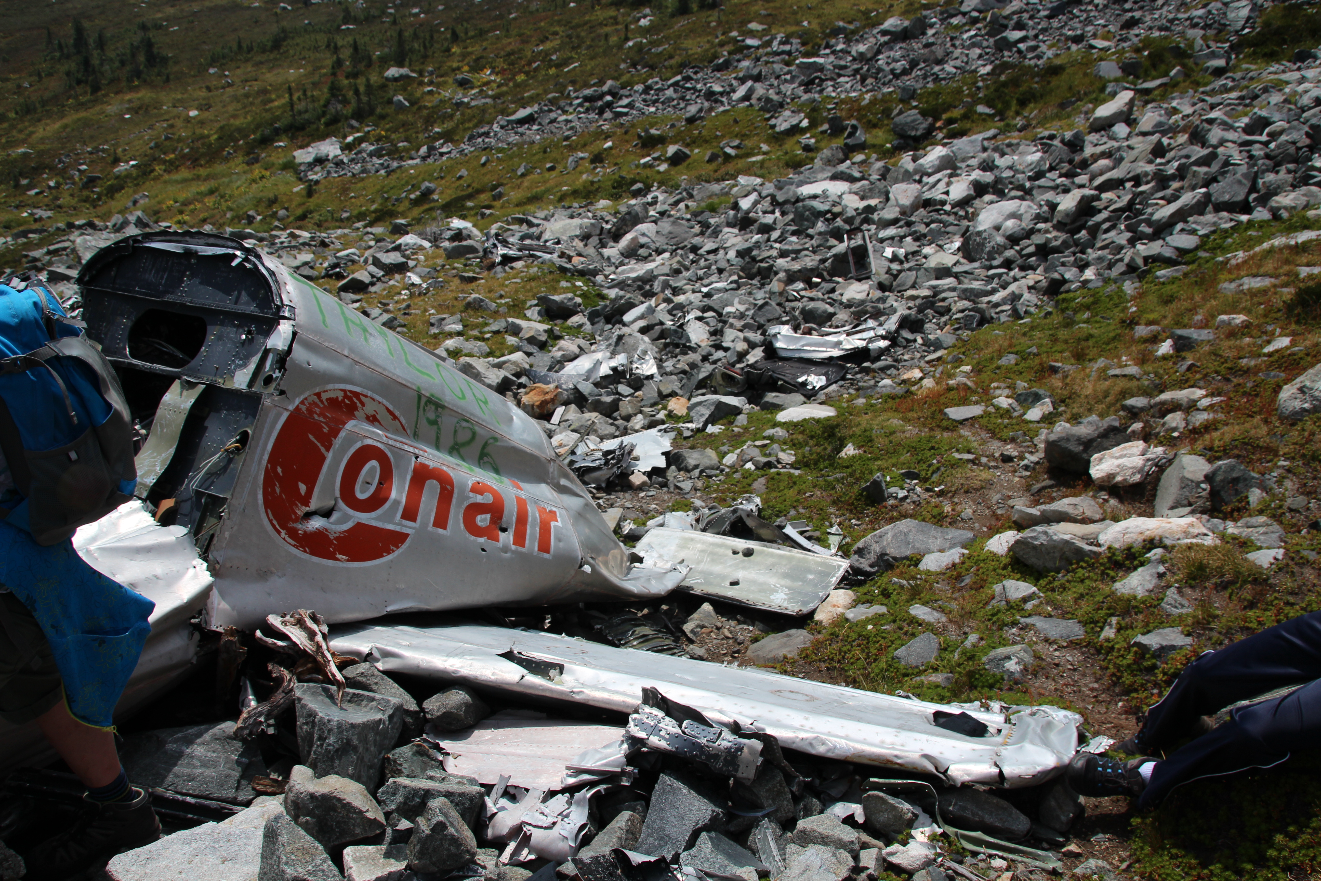
Conair #24
The wreckage we were visiting came from Conair #24 – a Douglas A/B-26 Invader that had started out in the US Air Force. Later, in 1957, it was registered as a civilian aircraft after it was sold to a private company. In 1971 it was purchased by Conair Aviation of Abbotsford where it would be used to fight forest fires. On August 10, 1971, it crash landed in Prince George, but survived to fly again.

This was Conair 24, the same wreckage we hiked to on Stoyoma Mountain.
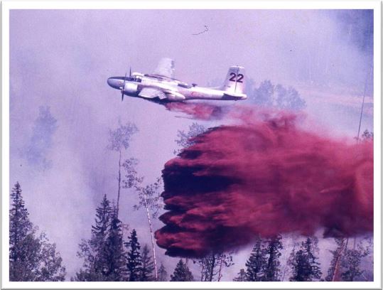
This is Conair 24’s sister plane, Conair 22, in action.
Three years later, almost to the day, on August 11, 1974, pilot Eric Yuill was flying Conair #24, fighting forest fires in a particularly bad summer for fires in the BC interior. By the time Yuill took off that day it was already one of the most tragic summers in the BC Forest Service firefighting program. On August 2nd, while fighting a fire 13 Km southeast of Ashcroft, a DC 6 Tanker (number 41) crashed killing all three crew members on board. Within 9 days two Douglas A26’s crashed, killing their pilots. The second was Eric Yuill. The wreckage of Yuill’s plane is still in its resting place on Stoyoma Mountain. According to one person who recalled the incident, Yuill’s plane wasn’t found for three weeks after the crash. I have no idea if this is true or not. But either way, it’s very sad.


Living in Kamloops we see the tankers and helicopters flying in and out of the airport all summer. The distinctive motors are sounds we connect with heat, wind, and the smell of smoke that hangs in the valley. In a way it begins to look routine. Planes fly out with retardant or water, planes fly back empty. No big deal… till one doesn’t return.
I couldn’t find any more information about Eric Yuill. If I do find some, and I’ll be looking, I’ll post an update here.

Why was this crazy?
Well, the road, for one thing, and the journey for another. Seriously, who would go on that road twice? That’s just wrong! But the journey… that’s another thing. How often do we say, “Oh, we should do that someday” and never do? Even when that thing is in our own back yard? That’s what makes it crazy. We can talk all we want about the cool things we want to do, but how many times do we actually do them?
Would I do it again?
Oddly enough, I would. If / when I buy a 4X4 vehicle then the ability to make it on the road to Cabin Lake will be my new minimum standard when I make my choice.
Huge thanks to John Buchanan (and Ava), Yvonne Odber, Sophie Odber, Landan Dick, Krista Dick, Jaydan Dick, Jody Lenarcic and Gerry Lenarcic for joining me on this adventure!
For more information:
Pictures and a brief history of Conair #24
http://napoleon130.tripod.com/id302.html
The Canadian Fallen Firefighters Foundation (Eric Yuill’s page)
http://www.cfff.ca/EN/fallen/detail/?id=677
History of Aviation in the BC Forest Service: A pictorial account for the BCFS Centennial November 2011 – Part 2 : Air Tanker Operations
http://www.bcfs100.ca/docs/pdf/1/481.pdf

It was our pleasure to go with you that day (again!) This is an awesome portrayal of the experiences we had up there! I, too, would go, and will go, again!
LikeLike